How River's Erratic Flow Shaped Land and Its Uses
The Potomac Bottomlands Trail offers a fascinating glimpse into the geologic past of this area. It bears the stamp of the Potomac River, a tireless force of nature whose watery path has shaped the face of western Montgomery County for millions of years. Along its current and past routes are swamps, upland forests, corn fields, and sod farms –diverse regions that reflect the range of soils and topography created by the river and its tributaries.
The scenery is explored in a ten-mile loop trail that starts from an old canal landing set on a mile-wide river terrace; skirts the foot of “redbed” uplands along Old River Road; climbs into a varied topography of oak woods and farm fields, some of them set on ancient river gravels; and descends again to the canal and river at Edwards Ferry. It is a leisurely three-hour bike trip with only one steep grade to climb.
The geology of the area is fairly straightforward. Picture thick layers of red sandstone and shale laid in horizontal “redbeds” about two hundred million years ago (during the Triassic Period). At that time western Montgomery County was a semi-arid basin much like modern Nevada. Sand and clay washed from the uplands during sporadic heavy rains spread in thick fans across the basin floor and over time hardened into rock. Today, this rock is hidden in parts by later flood-borne sediment but apparent in uplands north of River Road. It was quarried during C & O Canal days from bluffs at Seneca and underlies all the land traversed by the trail,
 Along the southern border of this area is the C & O Canal which was dug in the 1830’s as a way for communities and businesses along the Potomac River to transport coal, lumber, grain and other agricultural products to market. The river generally flows 10 or 20 feet below the old canal ditch, which was dug from a terrace of sediments deposited on top of the redbed rock along the Potomac. While most of the sediments were deposited millennia ago when the river channel stood much higher, major floods in 1936, 1942 and 1996, as well as from the high waters by Hurricane Agnes in 1972 have contributed to the sediments. Along the southern border of this area is the C & O Canal which was dug in the 1830’s as a way for communities and businesses along the Potomac River to transport coal, lumber, grain and other agricultural products to market. The river generally flows 10 or 20 feet below the old canal ditch, which was dug from a terrace of sediments deposited on top of the redbed rock along the Potomac. While most of the sediments were deposited millennia ago when the river channel stood much higher, major floods in 1936, 1942 and 1996, as well as from the high waters by Hurricane Agnes in 1972 have contributed to the sediments.
Additionally, thick deposits of upland gravel run in a band south from the mouth of the Monocacy River through the historic black community of Martinsburg to the intersection of Edwards Ferry and Offut Roads, and continue south to Sterling Park, Virginia, where they make a sharp loop north. Stained and rounded stones, some the size of melons, mark the course of the Potomac about a million years ago, before it swung west into its present horseshoe bend.
Active tributaries like Horseshoe Branch and Chisel Branch are adding still further refinements to the picture as they carve their own shifting valleys and channels.
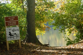 Parking. At Sycamore Landing there is a parking lot next to the C & O Canal. Take River Road to Sycamore Landing Road (4.1 miles from the modern highway bridge at Seneca Creek), turn off, and follow Sycamore Landing Road about 0.8 miles to the canal. There are no stores, restrooms or water at Sycamore Landing, but a National Park Service Hiker-Biker Camp with water and an outhouse is on the towpath a mile down river. Parking. At Sycamore Landing there is a parking lot next to the C & O Canal. Take River Road to Sycamore Landing Road (4.1 miles from the modern highway bridge at Seneca Creek), turn off, and follow Sycamore Landing Road about 0.8 miles to the canal. There are no stores, restrooms or water at Sycamore Landing, but a National Park Service Hiker-Biker Camp with water and an outhouse is on the towpath a mile down river.
1. Sycamore Landing Area
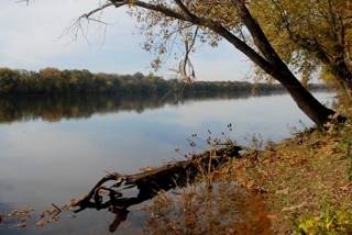 This was an old canal landing, known to boatmen as “rope harbor.” It is set on a broad terrace where the Potomac has shifted its channel back and forth between River Road and bluffs on the Virginia side to carve a two-mile valley that is prized for its soil fertility. This was an old canal landing, known to boatmen as “rope harbor.” It is set on a broad terrace where the Potomac has shifted its channel back and forth between River Road and bluffs on the Virginia side to carve a two-mile valley that is prized for its soil fertility.
Before unloading your bike, cross the nearby bridge and study the abandoned C & O Canal ditch. When constructed, the sides and bed of the ditch were lined with clay to keep precious water from percolating out, and since much of the liner has stayed  intact after the canal’s abandonment in 1924, silver maple, elm, spice bush and other wetland species have taken hold on the banks. The vegetation attracts legions of acrobatic insect-eating birds such as warblers, vireos, and fly-catchers. intact after the canal’s abandonment in 1924, silver maple, elm, spice bush and other wetland species have taken hold on the banks. The vegetation attracts legions of acrobatic insect-eating birds such as warblers, vireos, and fly-catchers.
Across the towpath, look over to tree-lined Van Deventer Island (called Maddox Island by some) once part of the terrace you are standing on, before the river carved a channel around it. Most of the soils from here to River Road are deep, well drained and among the most productive in the County. They are referred to as “alluvial” to indicate they were transported by the river from upland valleys, not eroded in place from the weathering bedrock.
Leaning toward the river just below your vantage point and identified by its arching white limbs is a relic of canal days, the last big sycamore at “Sycamore Landing.”
2. McKee-Beshers Wildlife Management Area
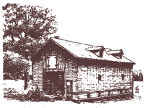
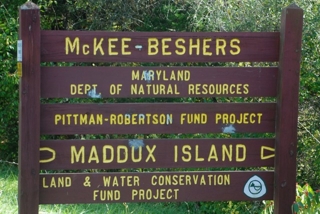 Because of their fertility and attraction for wildlife, the level fields around the parking lot saw intermittent use and occupation by the Indians, and were intensively farmed during canal days. Until 1924, canal boatmen stopped by at a nearby grain warehouse (known as “barracks” to old farm hands), to load wheat for the Georgetown mills, and return with fertilizer and summer delicacies such as watermelon. Even now, as part of the McKee-Beshers Wildlife Management Area, the land still yields food for the local wildlife, planted in strips of corn, shrubs and grasses. Because of their fertility and attraction for wildlife, the level fields around the parking lot saw intermittent use and occupation by the Indians, and were intensively farmed during canal days. Until 1924, canal boatmen stopped by at a nearby grain warehouse (known as “barracks” to old farm hands), to load wheat for the Georgetown mills, and return with fertilizer and summer delicacies such as watermelon. Even now, as part of the McKee-Beshers Wildlife Management Area, the land still yields food for the local wildlife, planted in strips of corn, shrubs and grasses.
From the parking lot, cycle north on Sycamore Landing Road to Horsepen Branch and River Road.
 3. Horsepen Branch 3. Horsepen Branch
You will cross Horsepen Branch in two places: first over a tributary where a former cattail marsh (on the left) has been choked by detritus and is being invaded by willows and again at the second bridge. Notice the red mud and flakes of red shale along the stream bed. The source of the waters of Horsepen Branch begin in the uplands where the soils were formed from the weathering of underlying redbeds and the stream has carried and deposited these materials along its bed and floodplain. Clays have pooled, settled, and become as impervious (similar to the canal bed), encouraging the growth of another wetland. Here, the vegetation masks the underlying sediment deposits and a deeper layer of Triassic “redstone.”
4. River Road Intersection
Straight ahead is the red, rutted drive of the old Trundle farmstead, which marks the high water line of the 1972 Agnes flood and the start of the redbed uplands. From here, cycle west (left) on River Road past the intersection of Willard Road to a second set of bridges on Horsepen Branch, where the pavement ends; follow the blacktop road along a shelf at the foot of extensive shale beds to Mt. Nebo Road (about 1.4 miles).
As you travel along the road, notice the road cuts. They are shale “mini-deserts” colonized by velvet-leaved mullein and tough shrubs like red cedar and sumac. Federal troops who marched on River Road during Civil War days probably collected soft mullein leaves to cushion their aching feet, and also cut spikes of sumac berries to boil and strain for homemade “lemonade.”
5. Horsepen Branch (again)
A second set of bridges crosses a tributary and then Horsepen Branch again, over swampy ground that features big sycamores on the streambanks. In the Agnes flood, backed-up water from the Potomac drove Horsepen Branch back on itself, pushing fish and driftwood upstream over the road and bridges.
 6. Large Shale Outcrop 6. Large Shale Outcrop
This is a nearly barren rock face, on the right about three hundred yards before the intersection of Mt. Nebo Road. Material washed from here and higher on the hill has created still another wetland on the flats below, marked by willows and a big white sycamore – small comfort to parched occupants of the shale bank.
7. Intersection of Mt. Nebo Road
River Road was at one time an Indian path, and later a tobacco rolling road (so named for the rolling of large wooden barrels packed with tobacco along its path). In 1808, the Maryland General Assembly designated the section from Edwards Ferry to Tenleytown in modern Washington DC as a public road, and it has been in continuous use ever since, broken today by the two-mile gap between this point and Edwards Ferry. Mt Nebo Road, named for an old farmstead that was just uphill on the left, is the detour. Land and farm buildings at the intersection are part of the Summit Hall Turf Farm. Go right and up the grade on Mt. Nebo Road.
8. Grade on Mt. Nebo Road
As you travel along the road examine the right side of the road cut for rounded cobblestones mixed with chips of shale bedrock. Potomac “bottomlands” were once a succession of river beds and terraces on the present upland, abandoned by the river as it shifted its channel to the west. A million years ago, these rocks bounced along the river bottom, being rounded and polished by river sand. Today these stones are found in a dry woodland, on the rim of a deep ravine cut by a tributary of Horsepen Branch. The underlying uplands made of red sandstone and shale, are full of joints and fractures that drain away subsurface water. Trees such as oaks and hickories have long taproots so they are able to thrive. At the top of the grade, pause for a spectacular view of the Catoctin and South Mountains to the west.
9. Old Fields and Hedgerows (along Mt. Nebo and Offut Roads)
After Indian days, almost all of western Montgomery County was timbered to make way for farms. Where before stood giant old-growth trees such as sycamore along streams, and white oak and hickory on uplands, today you’ll find plants that move in whenever people no longer cultivate the land. Blackberries, multi-flora rose, and goldenrod are among the first to pioneer in old redbed fields, followed by locust, persimmon, sassafras, and other saplings that can tolerate a dry environment and intense, direct sunlight. If undisturbed by fire or clearing, oak, hickory and dogwood will eventually succeed them.
Soil erosion and fertility depletion has turned the once rich farmland into marginal agricultural land. The upland area is too far from the modern river to be renewed by alluvium from periodic flooding so the area is now used primarily for pasture and to produce hay. Roadside vegetation found along the way is partly the work of songbirds, who perch on fenceposts and telephone wires and sow seeds in their droppings.
At the intersection of Offut Road, which comes in on the right, go straight and follow the pavement around two sharp bends to Edwards Ferry Road, about 0.8 miles from the intersection.
10. Intersection at Offut and Edwards Ferry Roads
The field on the right and the woodlots and road cuts on Edwards Ferry Road are full of large and small cobblestones, rounded and water-stained from having been on the bottom of a river. This is the largest deposit of old riverine material on the trail: Edwards Ferry Road exposes a cross section over a mile wide, including several boulders the size of beach balls. The topography may once have looked like Sycamore Landing – as the Potomac deepened its channel, materials that lined the sides of the old riverbed were left behind on the shore to become part of a wide terrace. Even today, after millennia of weathering, parts of this upland are remarkably flat.
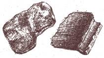 The former course of the Potomac that flowed a million years ago or more, and where its shifting channels and tributaries lay, have been traced from the deposits in this area and from similar evidence at Martinsburg, Mt. Nebo Road, and in Virginia. The old river, flowing down from the vicinity of Martinsburg through this area and south into Virginia, would have met the present horseshoe channel at right angles west of Sycamore Landing. Cobbles and pebbles washed and tumbled to this point from distant hills are now two miles from the present river at Edwards Ferry and about 120 feet higher. The former course of the Potomac that flowed a million years ago or more, and where its shifting channels and tributaries lay, have been traced from the deposits in this area and from similar evidence at Martinsburg, Mt. Nebo Road, and in Virginia. The old river, flowing down from the vicinity of Martinsburg through this area and south into Virginia, would have met the present horseshoe channel at right angles west of Sycamore Landing. Cobbles and pebbles washed and tumbled to this point from distant hills are now two miles from the present river at Edwards Ferry and about 120 feet higher.
11. Big Boulder
A sizeable boulder, made of quartzite rock whose nearest source is probably South Mountain, about 25 miles west, lies in a wood lot just off Edwards Ferry Road near a gate to the Old 99 Farm (on the left, 0.8 miles below Offut Road). Boulders this large may have been carried on ice floes and left in the riverbed when the ice melted.
From here, proceed to a steep grade and down to a “T” intersection where Edwards Ferry Road forks to the left and River Road resumes on the right. For an interesting ten mile side trip turn right on River Road, cycle to Whites Ferry and circle back on the canal towpath. River Road passes through bottomland woods and emerges to skirt large terraces that have been made into sod farms. If you decide against the detour, turn left at the intersection and proceed to the C & O Canal and Lock 25.
12. Edwards Ferry – Lock 25
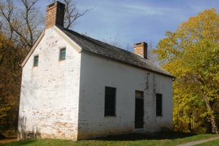 The approach to Edwards Ferry down a steep hill was a tricky one for farm wagons and a far cry from the level terrace at Sycamore Landing. Here the river has been constricted by uplands about a half mile apart, some of which it has carved into bluffs. From Edwards Ferry to Sycamore Landing, terrace deposits have built the land on both sides of the canal, except for the hill and redbed outcrops just below Lock 25. The lock was made from sandstone blocks cut from the quarries at Seneca. It was in operation from 1833 to 1924 when the canal closed. Edwards Ferry, which operated until 1936, connected the market towns of Poolesville and Leesburg, and ran from the Maryland side to a point near the mouth of Goose Creek, which you can see on the opposite shore. (For a description of the canal from Point of Rocks to Seneca, including Edwards Ferry, see the Sugarloaf Regional Trail Canal Trail Guide.) The approach to Edwards Ferry down a steep hill was a tricky one for farm wagons and a far cry from the level terrace at Sycamore Landing. Here the river has been constricted by uplands about a half mile apart, some of which it has carved into bluffs. From Edwards Ferry to Sycamore Landing, terrace deposits have built the land on both sides of the canal, except for the hill and redbed outcrops just below Lock 25. The lock was made from sandstone blocks cut from the quarries at Seneca. It was in operation from 1833 to 1924 when the canal closed. Edwards Ferry, which operated until 1936, connected the market towns of Poolesville and Leesburg, and ran from the Maryland side to a point near the mouth of Goose Creek, which you can see on the opposite shore. (For a description of the canal from Point of Rocks to Seneca, including Edwards Ferry, see the Sugarloaf Regional Trail Canal Trail Guide.)
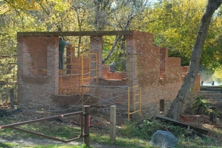 The Potomac River is about one-fourth of a mile wide here. Imagine the river transposed to the upland at Offut Road a million years ago, with a bank like the one you are standing on, and a wide terrace behind that. Early man had not appeared, but mammoth, mastodon and perhaps the saber-toothed tiger had worn paths to favored drinking holes across a scene dominated by mixed hardwood and evergreen trees. Since a glacier had advanced into parts of Pennsylvania and Ohio, the climate was colder than now and in winter and the waters of the Potomac were likely to be solid ice. The Potomac River is about one-fourth of a mile wide here. Imagine the river transposed to the upland at Offut Road a million years ago, with a bank like the one you are standing on, and a wide terrace behind that. Early man had not appeared, but mammoth, mastodon and perhaps the saber-toothed tiger had worn paths to favored drinking holes across a scene dominated by mixed hardwood and evergreen trees. Since a glacier had advanced into parts of Pennsylvania and Ohio, the climate was colder than now and in winter and the waters of the Potomac were likely to be solid ice.
From Edwards Ferry, the trail follows the canal towpath back to Sycamore Landing, a distance of about a three miles.
13. Chisel Branch Hiker-Biker Camp
Water and an outhouse are available, plus a fine view from the shore at the river’s level. Below this point the towpath resumes its position on a shelf above the river, which in summer becomes a path through arching limbs and head-high jewelweed.
14. Summit Hall Turf Farm
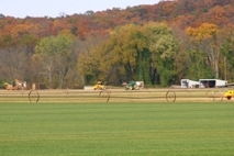 About 700 acres of alluvial fields are farmed in three-year cycles of grasses. This and other turf farms on similar terraces above Edwards Ferry supply turf to resod everything from lands cleared for metropolitan area subdivisions to football fields, golf courses, highway medians and recreational areas. About one inch of soil is removed with the sod when it is harvested. In this way the river’s rich soil bounty is being redistributed to various areas from which, in time, it will draw “new” sediment for channels and terraces yet to be carved. About 700 acres of alluvial fields are farmed in three-year cycles of grasses. This and other turf farms on similar terraces above Edwards Ferry supply turf to resod everything from lands cleared for metropolitan area subdivisions to football fields, golf courses, highway medians and recreational areas. About one inch of soil is removed with the sod when it is harvested. In this way the river’s rich soil bounty is being redistributed to various areas from which, in time, it will draw “new” sediment for channels and terraces yet to be carved.
To see the old hand drawn Trail Guide site maps for the Potomac Bottomlands Trail (now out of date), please go here.
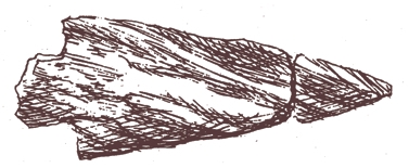
E. Wesely 1980
M. Martinez 1997
Betsy Lyman 2010 |

